Insight
Geospatial AI for Automated Highway Asset Inventory Generation
Published on April 25, 2026
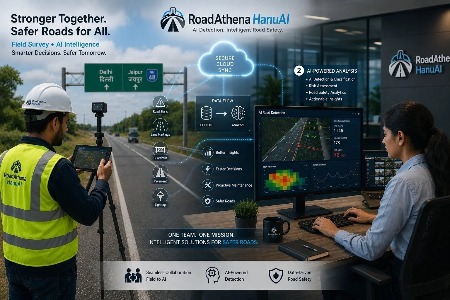
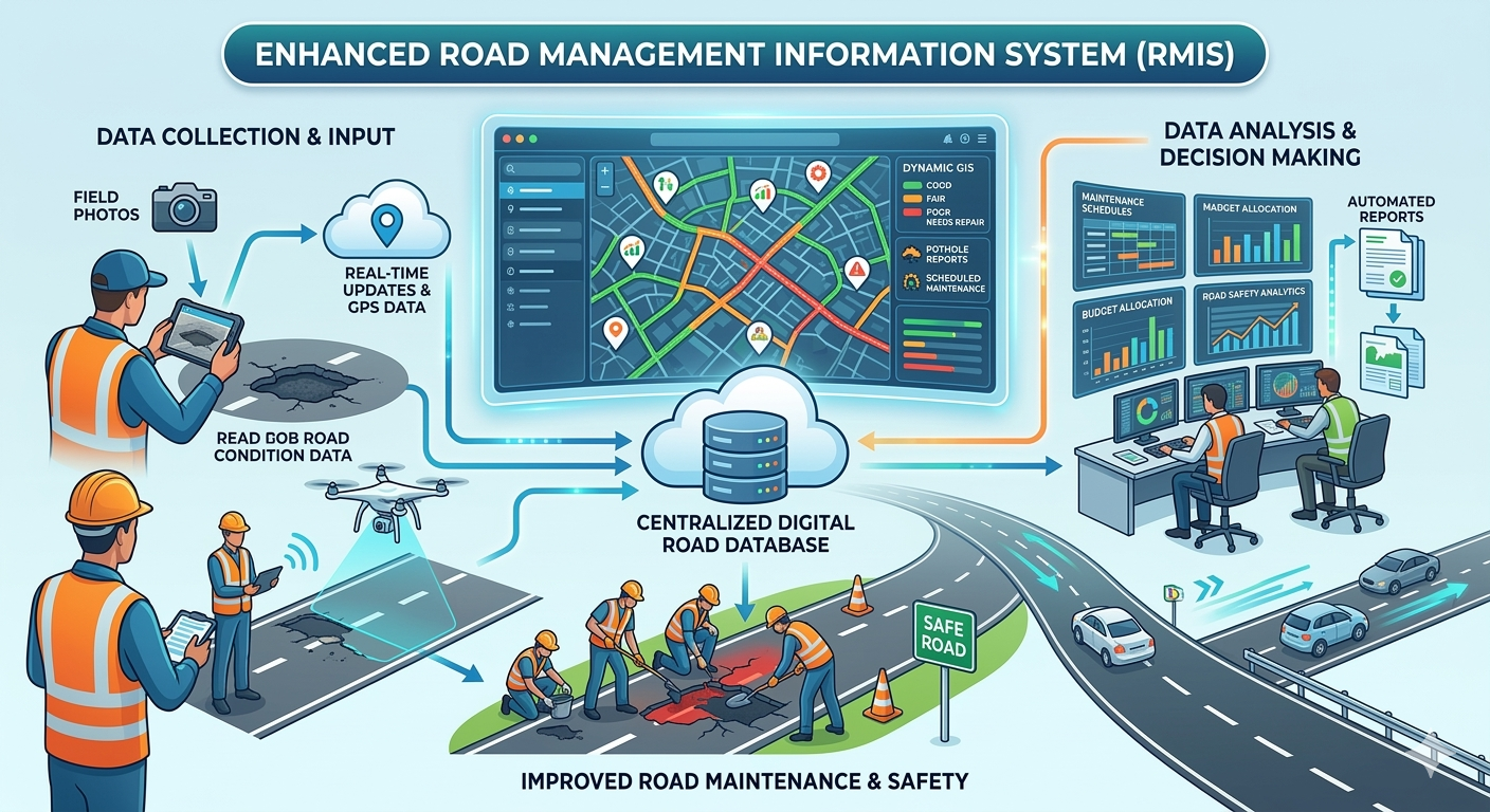
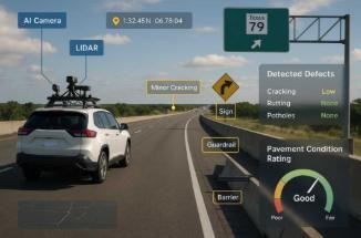
Efficient highway management begins with accurate knowledge of on-ground assets such as traffic signs, guardrails, lighting poles, and road markings. Traditionally, creating this asset inventory has been a manual and time-consuming process, where engineers review geo-tagged images and videos collected during surveys. While effective, this approach becomes difficult to scale for large highway networks. Geospatial Artificial Intelligence (GeoAI) offers a modern solution by automating asset detection and mapping, making the entire process faster, more consistent, and highly efficient.
GeoAI for Automated Asset Detection and Mapping
GeoAI combines geospatial data, computer vision, and machine learning to automatically identify roadside assets from survey data. Modern survey vehicles already capture large datasets using cameras, LiDAR, and GPS devices. GeoAI processes this data to detect objects such as signboards, barriers, kilometer stones, and drainage systems with high accuracy. Once detected, these assets are linked to precise GPS coordinates and integrated into GIS platforms for easy visualization and management. This automated workflow eliminates the need for manual tagging, reduces human effort, and ensures consistent results. It also enables faster creation of structured asset databases that can seamlessly integrate with systems like Road Management Information Systems (RMIS).
Improved Data Quality and Future Impact
Beyond automation, GeoAI significantly improves data quality and reliability. It can automatically validate datasets by identifying missing assets, duplicate entries, or incorrect classifications—issues that often go unnoticed in manual processes. This allows teams to focus only on flagged inconsistencies, saving time and improving overall accuracy. As a result, infrastructure authorities can rely on up-to-date and trustworthy data for decision-making. Looking ahead, GeoAI will play a critical role in building smarter infrastructure systems, enabling faster asset inventory generation, better maintenance planning, and more efficient highway management at scale.