Insight
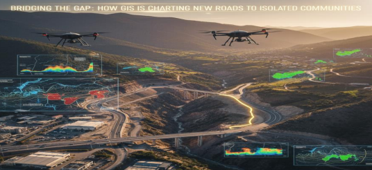
Bridging the Gap: How GIS is Charting New Roads to Isolated Communities
Published on January 01, 2026
In the heart of India's most stunning landscapes—the dense forests of the Northeast, the rugged hills of Central India, and the high Himalayas—lie communities living in the shadows of isolation. For them, a trip to the nearest clinic for a medical emergency can be a day-long trek. Getting produce to market before it spoils is a constant race against time. Education beyond the primary level is a distant dream, as children cannot commute to schools in towns. The absence of a reliable road is more than an inconvenience; it is a barrier to healthcare, economic opportunity, and education. Traditionally, plotting a new road through such complex terrain was an immense challenge, often based on rough surveys and gut instinct, leading to routes that were expensive to build, dangerous to use, and difficult to maintain. But a technological shift is changing this narrative. Geographic Information Systems (GIS) are now the compass and the strategist, enabling us to scientifically chart the optimal path to connectivity, turning isolation into integration.
The Challenge: Why Can't We Just Draw a Line on a Map?
Connecting point A to point B in mountainous or forested terrain is a complex puzzle. The
shortest distance is rarely the best, or even a feasible, route. Planners must answer critical
questions:
• Engineering: Where are the slopes too steep for a safe and cost-effective road?
• Environment: How can we minimize the destruction of forests, protected areas, and
watersheds?
• Economics: What route balances construction costs with the number of people it will
serve?
• Safety: How do we avoid landslide-prone zones and floodplains?
Answering these questions with traditional methods is slow, expensive, and often inaccurate.
This is where GIS moves from a simple mapping tool to a powerful decision-making engine.
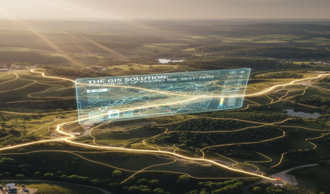
The GIS Solution: The Science of Finding the "Best" Path
GIS doesn't just show us where things are; it helps us understand the lay of the land in incredible detail and model the consequences of different choices. The process is a sophisticated form of multi-criteria decision analysis.
Step 1: Layering the Evidence
The power of GIS lies in its ability to layer different types of information on a single map. For a
new road corridor, key data layers include:
• Terrain & Slope (from Digital Elevation Models): Identifies steep, unstable, and
costly areas to build.
• Land Use & Land Cover: Highlights forests, agricultural land, wetlands, and built-up
areas to avoid.
• Geology & Soil Type: Pinpoints areas with stable foundation material versus loose,
erosion-prone soil.
• Environmental & Protected Areas: Ensures the route avoids ecologically sensitive
zones.
• Population Centers: The entire purpose—the route must effectively link the target
villages.
• Existing Infrastructure: The new road must seamlessly connect to the existing
network.
• Hazard Data: Integrates landslide and flood susceptibility maps (as seen in our
previous analysis of mountainous regions).
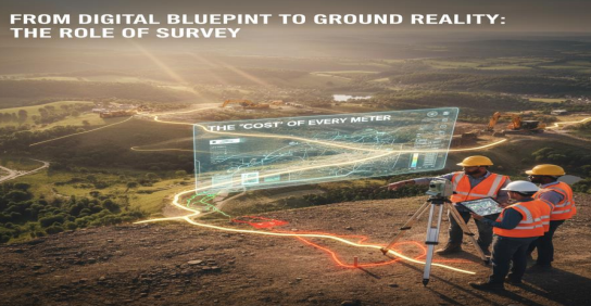
Step 2: The "Cost" of Every Meter
In GIS terms, "cost" isn't just money; it's a measure of overall suitability. The software analyzes
every pixel of the landscape and assigns it a "cost value" based on the layered criteria.
• A low cost pixel might be flat, stable, barren land, close to a village.
• A high cost pixel would be a very steep slope, a dense forest, or a high-risk landslide
zone.
By assigning weights to these factors (e.g., "avoiding steep slopes is 40% of our priority"),
planners can tailor the analysis to specific community and environmental goals.
Step 3: Running the Least-Cost Path Analysis
This is where the magic happens. The GIS algorithm takes the start and end points of the
proposed road and calculates the single path that accumulates the lowest total cost across the
entire landscape. It isn't the shortest path; it's the smartest path.
From Digital Blueprint to Ground Reality: The Role of Survey
The GIS-proposed route is a strategic corridor, not a precise centerline. This is where modern
surveying completes the loop.
• Drone Surveys: Drones are flown over the proposed corridor to capture highresolution imagery and create detailed 3D models. This validates the GIS data and
identifies micro-features like large boulders or small streams that satellites might have
missed.
• GNSS Rover Ground Survey: Survey teams use the GIS map as a guide. With highprecision GPS rovers, they stake out the precise centerline on the ground, providing the
exact coordinates and elevations needed for construction.
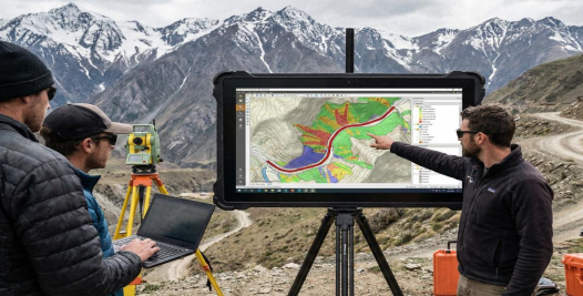
• Mobile GIS in the Field: Using apps like ArcGIS Field Maps or QField, surveyors can
update the GIS database in real-time. If they find an unexpected marsh or rock outcrop,
they can note it directly, and the digital plan can be adjusted on the fly.
The Impact: More Than Just a Road
When a road is built using this data-driven approach, the outcome is transformative:
• Resilience: The road is built on a stable alignment, resistant to landslides and erosion,
reducing long-term maintenance costs.
• Cost-Efficiency: By avoiding the most significant natural obstacles, construction is
faster and cheaper.
• Social Equity: It delivers connectivity to those who need it most, bridging the gap
between remote communities and essential services.
• Sustainability: The process minimizes environmental damage, ensuring that
development does not come at the cost of ecological health.
Conclusion: Charting a More Connected Future :-
The challenge of connecting the unconnected is immense, but it is no longer insurmountable.
GIS provides the foundational intelligence to make informed, sustainable, and life-changing
decisions. It moves us from reactive, guesswork-based planning to a proactive, scientific, and
compassionate approach.
By continuing to leverage this powerful technology, we can ensure that no community is left
behind, charting a course toward a future where every village, no matter how remote, is on the
map and connected to the world.
👋 Hi! I'm Hanu AI
Hanu AI Beta v2.0
Your AI assistant